Datei:Africa land cover location map.jpg

Größe dieser Vorschau: 635 × 600 Pixel. Weitere Auflösungen: 254 × 240 Pixel | 508 × 480 Pixel | 813 × 768 Pixel | 1.084 × 1.024 Pixel | 1.525 × 1.440 Pixel.
Originaldatei (1.525 × 1.440 Pixel, Dateigröße: 523 KB, MIME-Typ: image/jpeg)
Beschreibung
| Beschreibung |
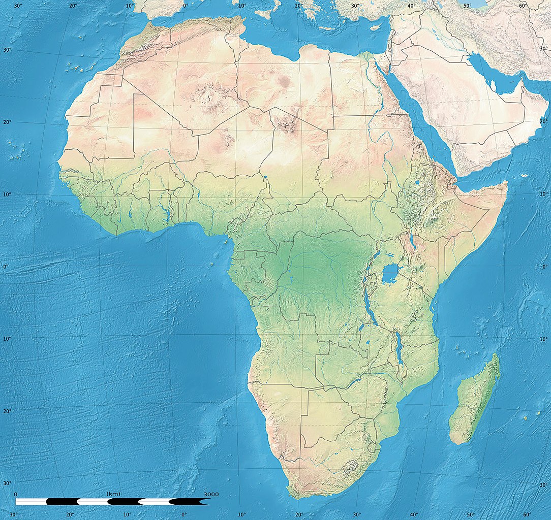
English: Simulated land cover map of Africa showing the natural aspect of the land with bathymetry as it could be seen from space; for geo-location purposes. Borders as in July 2011.
Français : Carte de la couverture du sol simulée de l'Afrique montrant l'aspect naturel des terres telles qu'elles seraient vues depuis l'espace, avec bathymétrie ; destinée à la géolocalisation. Frontières telles qu'en juillet 2011. Lambert azimutal equal-area projection, WGS84 datum
|
| Datum | Juli 2010, updated 2011-07 |
| Quelle |
Blank background map: Natural Earth II (public domain) by Tom Patterson, US National Park Service |
| Urheber | Tom Patterson and Eric Gaba (Sting - fr:Sting) |
| Genehmigung (Weiternutzung dieser Datei) |
Public domain |
| Andere Versionen |
|


| Kameraposition | | Dieses und weitere Bilder auf OpenStreetMap |
|---|
Lizenz
| This work was previously under Public Domain, or a Free License. It has been digitally enhanced and/or modified. This derivative work has been (or is hereby) released into the public domain by its author, Sting at the French Wikipedia project. This applies worldwide. In some countries this is not legally possible; if so:
|
Dateiversionen
Klicke auf einen Zeitpunkt, um diese Version zu laden.
| Version vom | Vorschaubild | Maße | Benutzer | Kommentar | |
|---|---|---|---|---|---|
| aktuell | 18:54, 14. Jul. 2011 | | 1.525 × 1.440 (523 KB) | wikimediacommons>Sting | Sudan/South Sudan 07-2011 border update |
Dateiverwendung
Die folgende Seite verwendet diese Datei: